SERN: Bandwidth-Adaptive Cross-Reality Synchronization for Simulation-Enhanced Robot Navigation
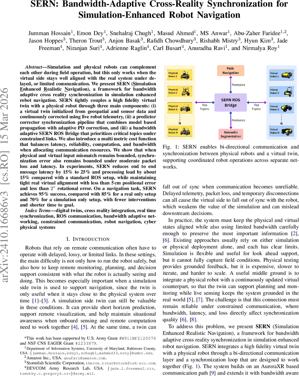
Cross reality integration of simulation and physical robots is a promising approach for multi-robot operations in contested environments, where communication may be intermittent, interference may be present, and observability may be degraded. We present SERN (Simulation-Enhanced Realistic Navigation), a framework that tightly couples a high-fidelity virtual twin with physical robots to support real-time collaborative decision making. SERN makes three main contributions. First, it builds a virtual twin from geospatial and sensor data and continuously corrects it using live robot telemetry. Second, it introduces a physics-aware synchronization pipeline that combines predictive modeling with adaptive PD control. Third, it provides a bandwidth-adaptive ROS bridge that prioritizes critical topics when communication links are constrained. We also introduce a multi-metric cost function that balances latency, reliability, computation, and bandwidth. Theoretically, we show that when the adaptive controller keeps the physical and virtual input mismatch small, synchronization error remains bounded under moderate packet loss and latency. Empirically, SERN reduces end-to-end message latency by 15% to 25% and processing load by about 15% compared with a standard ROS setup, while maintaining tight real-virtual alignment with less than 5 cm positional error and less than 2 degrees rotational error. In a navigation task, SERN achieves a 95% success rate, compared with 85% for a real-only setup and 70% for a simulation-only setup, while also requiring fewer interventions and less time to reach the goal. These results show that a simulation-enhanced cross-reality stack can improve situational awareness and multi-agent coordination in contested environments by enabling look-ahead planning in the virtual twin while using real sensor feedback to correct discrepancies.
💡 Research Summary
The paper introduces SERN (Simulation‑Enhanced Realistic Navigation), a middleware framework that tightly couples a high‑fidelity virtual twin with a physical robot to enable robust cross‑reality operation under constrained communication. Three core contributions are presented. First, a virtual twin is automatically constructed from static geospatial layers (digital elevation maps, vector data) and continuously corrected with live telemetry (odometry, IMU, LiDAR). The authors use a patch‑based update scheme: only the portions of the scene that have changed since the last synchronization are transmitted, dramatically reducing bandwidth compared with full‑scene refreshes. Geographic coordinates are transformed to a local metric frame and then to Unity engine coordinates using closed‑form equations, and a level‑of‑detail (LoD) policy with hysteresis selects high, medium, or low update rates for different map regions based on proximity to the robot and task relevance. Second, a predictor‑corrector synchronization pipeline is designed. When the communication link is healthy, the twin receives raw state updates; when packets are delayed or lost, a model‑based predictor propagates the twin’s state forward, and an adaptive PD controller corrects the prediction once fresh telemetry arrives. The authors provide a theoretical proof that, as long as the mismatch between physical and virtual inputs remains bounded, the synchronization error also stays bounded despite moderate packet loss and latency. Third, a bandwidth‑adaptive ROS bridge is built on top of the AuroraXR framework. Each ROS topic is assigned a criticality score κ(t). The bridge computes a priority score P(m) = κ(t)
Comments & Academic Discussion
Loading comments...
Leave a Comment