Transfer to Sky: Unveil Low-Altitude Route-Level Radio Maps via Ground Crowdsourced Data
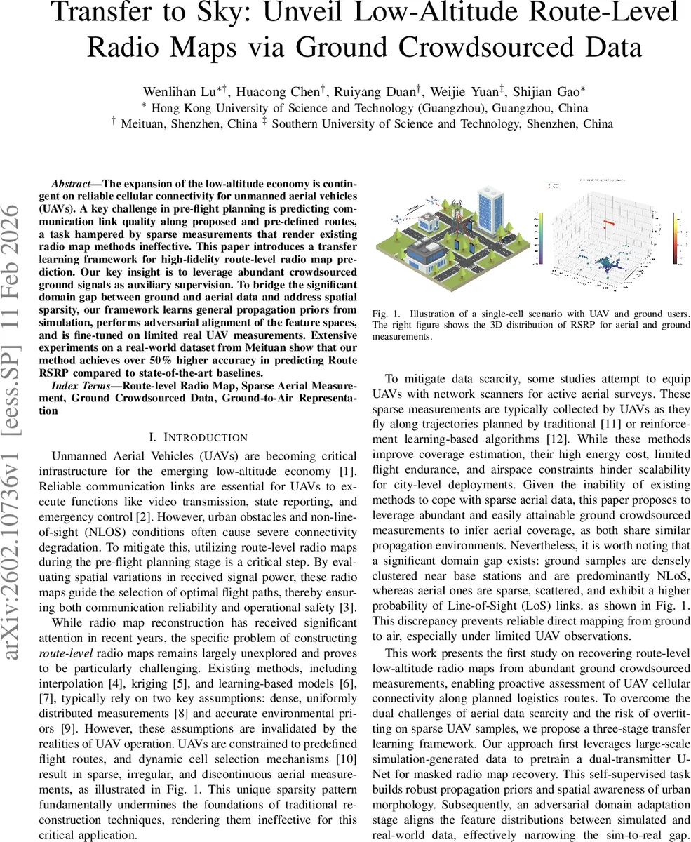
The expansion of the low-altitude economy is contingent on reliable cellular connectivity for unmanned aerial vehicles (UAVs). A key challenge in pre-flight planning is predicting communication link quality along proposed and pre-defined routes, a task hampered by sparse measurements that render existing radio map methods ineffective. This paper introduces a transfer learning framework for high-fidelity route-level radio map prediction. Our key insight is to leverage abundant crowdsourced ground signals as auxiliary supervision. To bridge the significant domain gap between ground and aerial data and address spatial sparsity, our framework learns general propagation priors from simulation, performs adversarial alignment of the feature spaces, and is fine-tuned on limited real UAV measurements. Extensive experiments on a real-world dataset from Meituan show that our method achieves over 50% higher accuracy in predicting Route RSRP compared to state-of-the-art baselines.
💡 Research Summary
The paper tackles the problem of predicting the received signal strength (RSRP) along low‑altitude UAV flight routes, a task that is essential for reliable cellular connectivity in emerging aerial logistics. Traditional radio‑map reconstruction techniques assume dense, uniformly distributed measurements, an assumption that fails for UAVs because aerial measurements are extremely sparse, irregular, and costly to acquire. To overcome this data scarcity, the authors propose a three‑stage transfer‑learning framework that leverages abundant ground‑level crowdsourced measurements (e.g., from mobile phones) as auxiliary supervision.
Stage 1 – Simulation‑based pre‑training: Using OpenStreetMap building footprints, height attributes, and digital elevation models, the authors construct city‑scale 3‑D environments. These are fed into the Sionna ray‑tracing engine to generate large volumes of synthetic 3‑D RSRP maps. A dual‑transmitter U‑Net is trained on a self‑supervised “masked radio‑map recovery” task: a distance‑biased mask removes portions of the map, and the network learns to reconstruct the missing voxels. The mask probabilities (p_near, p_mid, p_far) mimic the real‑world non‑uniform sampling density (dense near base stations, sparse farther away). The encoder is shared, while two transmitter‑specific decoders (enhanced with CBAM attention) learn complementary coverage patterns. This stage endows the model with general propagation priors and spatial awareness of urban morphology.
Stage 2 – Adversarial Domain Adaptation: The pretrained encoder is frozen, and a target encoder is initialized from it. An adversarial discriminator operates on the bottleneck features of both simulated (source) and real (target) masked inputs. Using the ADDA scheme, the target encoder learns to produce source‑like latent representations, thereby aligning the feature distributions of the simulated and real domains without requiring labeled aerial data. The two transmitter‑specific decoders remain frozen to preserve cell‑specific knowledge.
Stage 3 – Real‑world Fine‑tuning: After domain alignment, only the decoder(s) are fine‑tuned on the extremely sparse UAV measurements. The encoder stays fixed to retain the physically grounded latent space learned from simulation and adversarial alignment. A simple MSE loss between predicted and observed RSRP at the UAV sample locations updates the decoder weights. This decoder‑only adaptation balances preservation of propagation‑consistent features with calibration to real‑world signal variations.
Experiments: The authors evaluate the framework on a real dataset collected by Meituan, comprising both dense ground crowdsourced RSRP samples and sparse UAV measurements across an urban area. Performance is measured by RMSE (dB). Compared with seven baselines—including classical interpolation, Kriging, and recent deep learning radio‑map methods (e.g., RadioUNet, DeepRadioMap)—the proposed method achieves a 51.9 % reduction in RMSE. Ablation studies show that (i) simulation pre‑training dramatically improves performance over training from scratch, (ii) adversarial alignment further reduces the sim‑to‑real gap, and (iii) fine‑tuning only the decoder yields better results than fine‑tuning the entire network, confirming the effectiveness of the staged approach.
Contributions and Limitations: The paper’s key contributions are (1) introducing ground crowdsourced data as a scalable source of supervision for aerial radio‑map prediction, (2) combining simulation‑based self‑supervision with adversarial domain adaptation to bridge the substantial ground‑to‑air domain gap, and (3) demonstrating that a lightweight decoder‑only fine‑tuning suffices to achieve high‑precision route‑level maps despite extreme measurement sparsity. Limitations include the focus on a single cell ID; extending to multi‑cell, multi‑frequency, and dynamic traffic scenarios remains future work. The authors suggest that integrating multi‑cell cooperation, real‑time map updates, and temporal alignment between ground and aerial datasets are promising directions.
Overall, the work presents a practical and technically sound solution for pre‑flight cellular coverage assessment, enabling UAV operators to plan safe and reliable routes using high‑fidelity radio‑maps derived from readily available ground measurements.
Comments & Academic Discussion
Loading comments...
Leave a Comment