The study of a new gerrymandering methodology
This paper is to obtain a simple dividing-diagram of the congressional districts, where the only limit is that each district should contain the same population if possibly. In order to solve this problem, we introduce three different standards of the…
Authors: Pan Kai, Tan Yue, Jiang Sheng
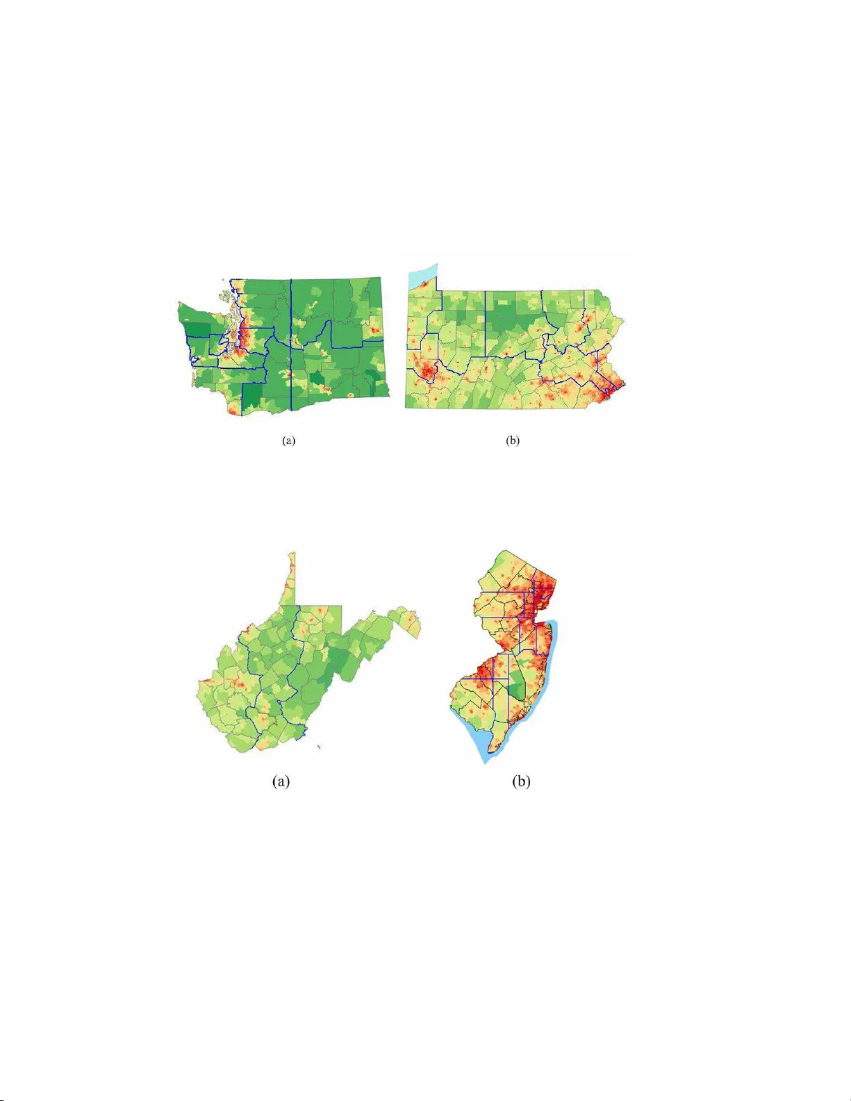
The study of a new gerrymandering metho dology ∗ P an Kai, T an Y ue, and Jiang Sheng Departmen t of Modern Physics, Univ ersit y of Science and T ec hnology of C h ina (USTC), Hefei, Anhui 23002 6, P .R.C h ina Abstract This pap er is to obtain a simple dividing-diagram of the congressional districts, where the only limit is that eac h d istrict should cont ain the same p opulation if p ossibly . In order to solv e th is problem, we in trod uce three d if- feren t standards of the ”simple” shap e. The first stand ard is that the fi nal shap e of the congressional districts should b e of a simp lest figure and we apply a mo dified ”sh ortest sp lit line algorithm” where the factor of the same p op- ulation is considered on ly . The second standard is that the gerrym andering should ensure the in tegrit y of th e current administrativ e area as the con v e- nience for managemen t. Th us we com bine the f actor of the administrativ e area with the first standard, and generate an impro v ed mo del resulting in the new diagram in w h ic h the perim eters of the districts are a long the b oundaries of some current counties. Moreo v er, th e gerrymandering sh ould consider the geographic features.The third stand ard is in tro duced to describ e this situa- tion. Finally , it can b e prov ed that the difference b etw een the su pp orting ratio of a certain part y in eac h district and th e av erage su pp orting ratio of that particular part y in the whole sta te ob eys the Chi-square distribution appro ximately . Consequen tly , we can obtain an archet ypal formula to c hec k whether th e gerrymandering w e p rop ose is f air. ∗ Suppo rted b y our deep in terests in ma thematical modeling. 1 Con ten ts 1 In tro duction 3 1.1 Issues in the Mo del . . . . . . . . . . . . . . . . . . . . . . . . . . . . 3 1.2 Previous W orks . . . . . . . . . . . . . . . . . . . . . . . . . . . . . . 4 1.3 Our Approach . . . . . . . . . . . . . . . . . . . . . . . . . . . . . . . 4 1.4 Our Result . . . . . . . . . . . . . . . . . . . . . . . . . . . . . . . . . 5 2 Basic Ger r ymandering Mo del 5 2.1 Acquiremen t of the P opulation Densit y Matr ix . . . . . . . . . . . . . 5 2.2 A Simple Mo del fo r Redistricting . . . . . . . . . . . . . . . . . . . . 5 2.3 Mo del Mo dification . . . . . . . . . . . . . . . . . . . . . . . . . . . . 6 2.3.1 A Basic Assumption . . . . . . . . . . . . . . . . . . . . . . . 7 2.3.2 Mo dification Metho d . . . . . . . . . . . . . . . . . . . . . . . 8 2.3.3 Our Algorithm . . . . . . . . . . . . . . . . . . . . . . . . . . 8 3 F urther Optimization of the Mo del 11 3.1 The Mo dification of Avoiding “Gerrymandering” . . . . . . . . . . . . 11 3.1.1 Brief Introduction . . . . . . . . . . . . . . . . . . . . . . . . . 11 3.1.2 Resolution . . . . . . . . . . . . . . . . . . . . . . . . . . . . . 12 3.2 The Mo dification of G eographic F eatures . . . . . . . . . . . . . . . . 15 3.2.1 Brief Introduction . . . . . . . . . . . . . . . . . . . . . . . . . 15 3.2.2 Resolution . . . . . . . . . . . . . . . . . . . . . . . . . . . . . 16 4 Conclusion and Analysis 16 4.1 Comparison of Our Tw o Mo dels . . . . . . . . . . . . . . . . . . . . . 16 4.2 Comparison With Other Mo dels . . . . . . . . . . . . . . . . . . . . . 17 4.3 Comparison With Curren t Districts . . . . . . . . . . . . . . . . . . . 17 5 W eakness and F urther Dev elopmen t 18 5.1 V erification o f the Impro v ed Mo del . . . . . . . . . . . . . . . . . . . 18 5.2 Realization of the Comprehensiv e Considerations . . . . . . . . . . . 19 6 App endix 20 References 22 2 1 In tro duc t ion Figure 1: (a)The ma p o f p opulation densit y [1] . (b)The shap e of districts pro duced b y simple mo del. (c)The shap e of districts pro duced b y improv ed mo del T o ensure the fairness of the election, the foremost task is to obtain a sc ien tific arrangemen t of the b oundaries of the congressional districts. Although the states constitution provide s the n um ber of represen tativ es eac h state may hav e, it articu- lates nothing ab out ho w the district shall b e determined geographically . This o v ersight has now aday s led to an unnatural district shap e whic h includes man y long and narro w areas. T a king the state of New Y or k a s an example, on the map of current congressional districts [2] , we can see that there are some unnatural- shap ed districts, suc h as districts 20 th and 22 nd (sho wn in F igure 12(a)). T o create the “simplest” shap es, where t he only limit is that each district should con tain the same p o pulation if p ossibly , w e in tro duce thr ee differen t standards of the s implicit y: 1. Eac h district is appro ximativ ely a rectangle. 2. Based on the a b o v e standard, the outline s are b est along the b o undar ies of coun ties. 3. The mo difications o f geographical features and fairness are com bined in the final mo del. Therefore, we should take in to accoun ts comprehensiv e factors including the p opulation, t he b o undaries of counties, geographic features and fairness when g er- rymandering. 1.1 Issues in the Mo del • The first ob jectiv e is to divide the state in to some districts follow ing the rule that the p opulation of each district m ust b e same. 3 • As the s econd ob jectiv e, w e wish to mak e the b o undaries of the districts a s simple as p ossible according to the 1 st standard we ha v e pro p osed ab ov e. • The third ob jectiv e is that w e nee d further modifications considering the stan- dard 2 and standard 3. 1.2 Previous W orks There a r e many existing metho ds to r ealize the gerrymandering, with the considera- tion of different asp ects. F or instance , the “shortest split line algorithm” [3] considers the simplicit y of the shap e as k ey fa ctors. Another metho d, whic h uses the statis- tical ph ysics appro a c h, takes ev ery c oun t y as a s ingle elemen t of a matrix, mak es an a na logue to the q-state p ots [7] mo del, and gets the optimal solution kee ping t he in tegralit y of a count y . Other approac hes suc h as the “ fixed district algorit hm” [3] and the “c hanging the v oting system metho d” [3] mainly consider the un biasednes s of the election as the crucial f actor. In our work, the fo remost task is to make sure the simplicit y of the shap es of districts. Therefore, we mo dify the “shortest split line algorithm” to establish o ur initial simple mo del. The main mo dification is that we only use horizontal line and v ertical line instead of diagona ls. In this w a y , w e can get simple rectangles other than irregular p olygonal districts. While in the se ction of Mo del Mo dification w e dev elop a new metho d to ensure the p erimeter of the districts are along the b oundaries of the curren t coun ties. 1.3 Our Ap p roac h • First, w e obtain the p opulation density matrix from t he densit y map. • In order t o obtain a simple shap e of districts, we only tak e in to a ccoun t the rule that ev ery district should ha v e the same p opulatio n to establish a simple mo del. • Then w e optimize our mo del b y adding the mo dification of the presen t shap es of coun ties and g ain a more nature lo oking figure. • Based on the results from the forgoing simulation, w e finally in v estigate in to the factor of geog raph y and fairness in detail when gerrymandering. 4 1.4 Our Result According to the steps men tioned ab ov e, F igure 1 show s our results when applying our mo del to the state of New Y ork. 2 Basic Ge r r ymande ring Mo del In o r der to establish our basic mo del, w e first obtain a p o pulation density mat r ix using the p opulation map. W e then e stablish a simple mo del with the only con- strain t b eing t ha t eac h district ha v e the same p opulation. Finally , w e o ptimize our mo del b y adding additional constrain ts suc h a s prev enting the division of original administrativ e ar eas. 2.1 Acquiremen t of the P opulation Densit y Matrix T o calculate the p opula t io n eac h district con tains, we m ust first extract the p opula- tion density matrix for later computer progr a mming from the existing census data of some big cities and the macroscopic p o pulation densit y map. F or the or iginal colored p opulation map, w e use Matlab to iden tify the color of ev ery pixel. Th us w e can get the populatio n densit y corresp onding to the particular pixel though whic h w e obta in the p opulation densit y matrix. Moreo v er, this matrix can b e sho wn as a grey leve l figure(Figure 2). Figure 2: (a )The colored map of p opulation densit y . (b)The grey fig ure of p opulation densit y 2.2 A Simple Mo del fo r Re districting In order to obtain simple shap es for congressional districts, w e mo dified the origina l “shortest split line algorit hm” and dev eloped a simple algorithm to divide districts. 5 In our mo del: • W e fo cus on k eeping an ev en distribution of p opula t io n in eac h district, ignor- ing other factors. • The algorithm t ak es as input only the p opulation densit y matrix and ignor es other factors suc h as party lo y alties o f the citiz ens, th us gua r an teeing un biased results. • W e use horizontal and v ertical lines to separate the state result in fairly rect- angle districts. The pro cedure of the algorithm can b e sho wn in F igure 3. This district-dividing algorithm has the adv a n tage of simplicit y , clear unbiased - ness, and it pro duces fairly nice-lo oking rectangle districts. The adv an tages of the simple mo del: • Simplicit y • Clear un biasedness • F airly nice-lo oking rectangle districts. The disadv an tages: • F ails to ta k e in to consideration other fa ctors suc h a s geographic features and in tegralit y o f the counties. 2.3 Mo del Mo dific ation Despite o f its adv antage of simplicit y , the original mo del has the disadv antage of ignoring the shap e of administrativ e area and geographic features. As the figures sho w, the b o undaries pro duced b y the original a lg orithm some time s divide a count y whic h is an administrative a r ea into differen t parts. This can pro ve incon v enie n t and unnatural when carrying out the election pro cedures. T o disp el this disadv antage, w e made the f o llo wing improv emen ts to our orig inal mo del: 6 Figure 3 : The pro cedure of the algorithm of the simple mo del. 2.3.1 A Basic Assumption Before taking into cons ideration additional factors in dividing the coun ties, we need to mak e the follo wing assumption: we assume that tw o dis tricts share approximately the same p opulation if the difference in their num b ers of v oters is no more than 5%. In reality , it is imp ossible to divide districts into absolutely equal n um b ers of v oters due to the influence of p opulation flo w and the fluctuation of birth and death rates. And most of t he constitutions also a llow the the standard deviation of n um ber of v oters to fa ll within 10 − 15 % [7] . 7 2.3.2 Mo dification Metho d After making up the designs of landform, w e are faced with a problem - how to adopt the b orderline to a v oid dividing up administrative districts. T o solv e this problem, w e hav e to adopt the b orderlines b etw een the administrative districts. W e follo w the lines in bulge and conca v e in some district. As w e think the densit y in p o pulation almost equals close to b orderline b et w een districts. T aking into account the fa cto r s of populatio n, la ndform a nd managemen t, w e tak e this division as a simple meaning in manag ement. 2.3.3 Our A lgorithm The basic consideration o f this improv ed mo del is the same with the ab o v e simple mo del. How ev er, in that mo del, the dividing lines are all straigh t and th us cannot k eep a single coun t y in tegrate. Now we are trying to o ve rcome this shortcoming and do our b est to mak e the dividing line coincide with the b oundary of each adminis- trativ e area, although coun t y dividing is una v oidable. Step 1: Use the simple mo del t o find the straight dividing line. Figure 4: step 1 8 Step 2: Find all the in tersections b et w een the straight line and the count y b oundaries. Then in the progra m, use “ coun t” the in teger to represen t ho w man y crosso v er p oin ts there are on the straigh t line and use array point[coun t] to r ecord the lo cation o f all these interse ctions. Figure 5: step 2 Step 3: There must b e 2 or 3 direct paths along the straig h t line or the b oundary of the coun t y the straight line go es through connecting the t w o inters ection p oin ts. W e are trying to decide which of the t w o paths a lo ng the b oundary is more “ simple”. The “simple” path should b e the b oundary whic h connects the adjoining p oin ts and more close to the straight line. First w e find the p oint on the straig ht line whose co ordinate p osition is 2 or 3 units a wa y from the in tersection. W e separately searc h the p o ints left and right to it (tak e ve rtical line as a n example , for ho r izon tal lines the 2 directions w ould b e a b o v e and b elow ). The direction w e finally c ho ose would b e the o ne on whic h we arriv e at the b oundary earlier. W e record the direction c hosen in array path[count-1], if the direction is left o r up w ard, pa th[i]=1, if it is right or down w ard, path[i]=3. This metho d ma y not b e v ery strict, but it is easy to realize and tak es v ery little time for the computer to execute. Step 4: Ev ery straigh t line b etw een t w o adjo ining p oints and the b oundary line c hosen in step 3 can confine a small a r ea. W e calculate the p opulation in each small area b y sum up the elemen ts of the p opulation densit y mat r ix including in the area. P a y atten tion that if the area is to the left or b elow the straig h t line, prescrib e that s[i] is negative , otherwise, it is p ositiv e. W e sav e the result in array s[coun t-1]. 9 Figure 6: step 3 Figure 7: step 4 Step 5: In this step w e will finally decide the dividing line - its shap e and lo cation. W e no w kno w all the p oints on the dividing line and w an t to decide the lines jo ining the p oin ts. W e use arra y path[coun t- 1] to describe these lines. path[i] stands for the line connecting the i th p oin t and the ( i+ 1 ) th p oin t. path[i] =1,2 ,3 stands for the 1 st , 2 nd , 3 th path count from left to r igh t or do wn w ards to upw ards. The principles w e use t o decide whic h path to c ho ose is lik e this: First, while w e replace the initial straight line with the b oundary line, the p op- ulation of differen t congressional districts will v ary to eac h other. So the differences m ust b e con trolled within a certain range. Second, w e should use as little as p ossible straight lines, b ecause c ho osing a straigh t path means one count y will b e divided into t w o. The metho d is as fo llo ws: 10 Figure 8: step 5 In step 4 w e get the ar r a y s[coun t-1 ], we first sum up all the elemen ts in s[coun t- 1] and get the result S. Judge whether S < delta , here, delta can b e the theoretical p opulation of a congressional district m ultiple with the allow ed r a nge of error (in our progra m w e c ho ose the range as 5 %), if so, w e consider curren t path is qualified and we get the final arra y path[count-1], exit lo op; if not, we find s[i] whic h is closest to S ( | S − s [ i ] | is the minim um), and let path[i]=2 (c hange t he path to the stra ig h t line)let S = S − s [ i ], return t o judge whether S < delta , ... ,and lo op like this. After exiting the lo op, prin t t he lo cation of t he initial straigh t line and its end p oin ts, p oint[coun t] and pat h[count-1]. The final dividing line w e get with this metho d ma y not b e the optimal line, but it is qualified. The metho d can av oid considering a ll the p ossible combination of paths and thu s can op erate v ery fast. Step 6: D o the recursion a s the simple mo del and get all the dividing line. 3 F urther Optimiz ati o n of the Mo del Except shap e and coun t y integrit y , o ther factors should also b e take n into a ccount in a ctual gerrymandering. F or example, how to a v oid biased “gerrymandering, how to mo dify our mo del in sp ecial landform, as w e are g oing to represen t. 3.1 The Mo dification of A v oiding “Gerrymandering” 3.1.1 Brief In tro duction There are t w o principal strategies b ehind gerrymandering [3 , 8] : maximizing the ef- fectiv e v otes of supp orters, and minimizing the effectiv e v otes of opp onen ts. One 11 form of gerrymandering, pac king is to place as man y v oters of one ty p e into a single district to reduce their influence in other districts. A second form, crac king, in volv es spreading out v oters of a particular type among man y districts in o r der to reduce their represen tation b y den ying them a sufficien tly large v oting blo c k in an y par t ic- ular district. The metho ds are t ypically com bined, creating a few “forfeit” seats for pac k ed v oters of one type in order to secure eve n greater represen ta tion f or v oters of another ty p e. Figure 9: [3] Redra wing the balanced electoral districts in this example creates a guaran teed 3-to- 1 adv an ta ge in represen tation for the blue v oters. Here, 14 red v oters a re pac k ed into the y ello w district and the remaining 18 are crack ed across the 3 blue districts. 3.1.2 Resolution Because the simple algo rithm we based on uses only the shap e o f the state, the n um ber m of districts w an ted, and the p opulation distribution as inputs - and do es not kno w the party loy alties of the v oters in an y giv en region - the result cannot b e biased [3 , 9] . Ho w ev er w e can not completely prev en t t he certain v oter biases from o ccurring due to the random redistricting pro cess - although the probability is small. As a result, we need mak e a mat hematical analysis to determine whether the gerryman- dering our mo del pro p osed is fair. • Model assumption : Due to the the influence of p opulation flo w and the fluctuatio n of birth, death and the supp orting ratio of a p olitical party . It is reasonable to assume tha t the supp orting ratio of a particular part y in eac h district is incorrelate o f one another appro ximately . Next we w ould analyze how to judge the fa ir ness of the gerryman- dering to a specific party (Republican in our example) ; other parties and situations can b e judged via the same metho d. 12 • Mathema tical Analysis : x j i = 1 I f the i th v oter in the j th distr ict su ppor t the Republ ican 0 O ther w ise (1) If p j represen ts the supp orting ratio of the Republican in j th district a nd this district has n voters, then w e would expect to get (3.2) p j = P n i =1 x j i n . (2) Let p b e the last-few-y ear av erage supp orting ratio of the Republican in the whole state. Thus w e can exp ect that p ≈ P m i =1 p j m . (3) Ob viously , x j i is distributed b y B(1,p). X j = r n p (1 − p ) ( p j − p ) = r n p (1 − p ) ( P n i =1 x j i − np n ) = P n i =1 x j i − np p np (1 − p ) ∼ N (0 , 1) (4) According to the statistics t heory , X j ob eys N(0 ,1), if n is large enough. Then it is reasonable to obtain the fo llo wing deduction: Y = m X j =1 X 2 j ∼ χ 2 m , (5) Here m indicates the num b er of districts in a certain state. Th us, w e can use Equ.(3.5) to generate a simple but effectiv e standard to judge the fairness o f the original gerrymandering. 13 According to the statistics theory , if w e get the p opulation densit y of the sup- p orting ra t io of t he Republican, it is easy to gain Y using the data p j and p. After that, the fo remost task is to determine a parameter α allow scien tifically . The parameter α allow functions as a threshold to judge whether the curren t gerry- mandering is bias or not. Then from the data ta ble of distribution χ 2 , we can get the v alue α where P ( X > Y ) = α . Here X stands for the random v ariable distributed b y χ 2 m . Figure 1 0: (a)P ac king strategy (b)Crack ing strategy On one hand, if there happ ens the “pac king” situation, we w o uld exp ect α to b e extremely small. Therefore, if α allow > α , w e can judge this g errymandering as pac king situation leading to unfairness. On the other hand, if “crac king” situation happ ens, w e can exp ect 1 − α t o b e extremely small. W e consider t his gerryman- dering biased as the same (sho wn in Fig ure 10). In conclusion, if the gerrymandering is fair, the v alue of α pro duced b y it w ould comply with following limits. α > α allow N ot “ pack ing ” 1 − α > α allow N ot “ cr ack ing ” . (6) W e can briefly obtain the final limit o n v a lue α (sho wn in Figur e 11), that is α allow < α < 1 − α allow . (7) • Conclusion: 14 Figure 11: Perm itted Y Domain After g enerating the “simp le” congressional districts, w e can use Equ.(3.5) and (3.7) to judge whether it satisfies the requiremen t of f airness, if we can collect the sup- p orting r a tio of the Republican in eac h district, the last-few-y ear av erage supporting ratio in the whole state a nd the parameter α allow . If it is not a fair gerrymandering, w e need to reconsider the pro cedure o f redistricting. 3.2 The Mo dification of G eographic F eatures Up till no w, man y mo dels that can realize gerrymandering ha v e existed. Th us comparison b etw een all kinds of gerrymandering results is necessary . W e are going to further analysis the characteristic of our tw o mo dels while comparing the results w e get with others. 3.2.1 Brief In tro duction Ab o v e-men tio ned metho d has ignored landfo rm factors such as main riv ers, moun- tains, lakes in pro cess of choosing partition, th us it has made district part it io n unnatural. Here w e make some improv emen ts. As to main rivers , mountains and so on, we hold the view that along the riv er, p opulation b enefit in econom y comparative ly resem bles. On this basis, the areas on the rive r should b e one district. 15 3.2.2 Resolution Our o p erations are as follows: 1. A new district with a large p opulation is based on expanding along the riv er and mountains. Considering the adv an t ages of t he long river or deep moun- tains, as w ell as conv enience in managemen t, more districts will b e formed if the p opulat io n increases. 2. T o the large lak e, we ex pand the area in to sev eral districts along the bank, for they are blessed with the same interes t in econom y . 3. T o the area of moun tains and plain, we consider dev eloping them separately as a result of differen t demands in b enefit. 4. The s ame thinking is practical along t he coastline. W e assem ble p eople on the coast in to sev eral districts, to separate the areas of coastline fro m inland to help the dev elopmen t fro m the coastline to the inland. 5. Considering the a ppro ac hing in terest in economy , the area of islands a nd b y- lands is b eing considered alone. A sp ecial zone will b e built. With these fa cto r s of landform b eing conside red alone, priorit y to ev ery electoral district deducted, to the part remaining again, w e will carry out the prev ious simple op eration according to the simple mo del. 4 Conclus ion and Analysis 4.1 Comparison of Our T w o Mo dels W e ha v e fully established tw o mo dels - the simple one and the refined one, b ot h of whic h a re easy to realize. Eac h o f these tw o mo dels has its ow n prominen t adv antages. As to the simple mo del, first of all, the final shap es of the congressional districts are all v ery simple, constructing with horizontal and v ertical lines o nly . Moreov er, the simple mo del guaran tees that eac h district con tains the same p opulation if giv en a precise p opulation division. While to the refined mo del, w e can maintain t he in tegrit y of ev ery single coun t y to a large exten t, whic h ease the managemen t of actual v oting. Whats more, a lthough the p opulatio n of districts v a ries fro m eac h other, the diff erences can b e controlled theoretically to any prop osed precision. 16 4.2 Comparison With Other Mo dels There are many existing metho ds to realize the gerrymandering with the consider- ation of different asp ects. Here w e compares our mo del with the “shortest split line algorithm” and the “q-state p ots mo del”. F rom the theoretically a nalysis and the final result, w e can see that o ur metho d has its merits. First, one imp orta nt task for us is to mak e sure the simplicit y of the shap es of districts. Therefore, we mo dify the “shortest split line algorithm” to establish o ur initial simple mo del. The main mo dification is that w e o nly use horizon tal line a nd v ertical line instead of diagona ls. In this w a y , w e can get simple rectangles other than irregular p olygonal districts pro duced b y original “shortest split line a lg orithm”. Secondly , we think the “q-state p otts mo del” is excellen t. The foremost ch arac- teristic of it is that this mo del k eeps the in tegrit y of counties. How ev er, the difference of dis trict p opulations can just b e controlled within 15%, while this difference in our mo del is no more than 5%. In sum, the adv antages of our mo del is that: 1. Easy to carr y out in the computer. 2. Simple shap es o f the districts. 3. Com bined with the factor of av oiding dividing up the curren t administrativ e ares. 4. The difference of district p opulations can b e con trolled in any precision. 4.3 Comparison With Curren t Districts F rom Figure 12, w e can clearly see the difference b etw een the curren t (the left one) districts a nd the redistricting prop osed b y our mo del. Through careful compar ison, w e can draw the conclusion that each has its adv antages. The c urren t shape of districts o wn its great merit that it tak e in to t he geographi- cal consideration. F or example, the district 20 th is built along the Lak e Ontario and the district 22 nd mainly consists of plain. Both sho w the mo dification of geogra phic features. Although there is some merit in the curren t district, the gerrymandering result pro duced by our mo del still sho w its adv antages. 17 Figure 1 2: Comparison With Curren t Districts 1. The shap e of most districts are r ectangula r satisfying the retiremen ts of the “simplicit y”. 2. Most of the p erimeters of the district a re alo ng the b o undaries o f curren t coun ties resulting in t he con v enience of manag emen t. 3. Last but no t least, the diff erence of district p opulations is no more than 5%, and can b e controlled in an y precision. Finally , we ha v e generated a simple but effectiv e criterion to judge the fairness of the gerrymandering via the reasonably mathematical analysis whic h mak es the mo del as a whole. 5 W eakness and F urt h er Dev elopmen t Although our t w o mo dels a r e reasonable and easy to realize, the final gerrymandering mo del still hav e some weak ness whic h needs f urther improv emen t. 5.1 V erification of the Impro v ed M o del Although we ha v e implemen ted the improv ed mo del to tak e in to consideration the fairness of v oter distribution by pa rt y , w e cannot obtain the data on populat io n den- sit y f av o ring resp ectiv e parities or on supp orting ratio o f a sp ecific party . Therefore w e can not put that part of the mo del in to practice. In a no ther word, if w e w an t to pro v e t he effectiv enes s and fairness of t he mo del w e should tr y our b est to in v estigate suc h data and further correct our simulations a nd mathematical analysis. 18 5.2 Rea lization of the Comprehensiv e Considerations Although w e hav e noticed the imp ortance of geographic features when gerryman- dering, due to the complexit y of our curren t mo del considering another key factor - av oiding separating administrative areas, w e ha v e not achie v ed the goal that pro- grams the a lgorithm considering the landform mo dification. Th erefore, our next mission is to realize the comprehensiv e considerations including geographic fa cto r s. 19 6 App endix Applications to Other States Figure 1 3: (a)W ashington (b)P ennsylv ania Figure 14: (a) W est Virginia (b)New Jersey 20 Figure 1 5: (a)Wisconsin (b)Uta h 21 References [1] P opula t ion densit y maps of all the states, http://www.ans w ers.com , Accessed F eb 10th, 2007 [2] Curren t congressional districts of a ll the states, h ttp://www.cens us.go v , Ac- cessed F eb 10th, 20 07 [3] Gerrymandering - Wikip edia, the free encyclopedia, h ttp://en.wikipedia.or g /wiki/Gerrymandering , Accessed F eb 9th, 2007 [4] Cognitiv e Asp ects of Gerrymandering, h ttp://www.springerlink.c om/index , Accesse d F eb 10th, 2007 [5] P opula t ion list of all the counties in the state of New Y ork, h ttp://www.cit yp opula t io n,de/USA-New Y ork.html, Accessed F eb 9th, 2007 [6] Curren t congressional districts of all the states, h ttp://nationalatlas.gov/prin ta ble/congress.h tml , Accessed F eb 11st, 2007 [7] Hun ting t o n News, h ttp://www.h untingtonnews.ne t/national/06 1006-shns-elections.h tml , Accesse d F eb 11st, 2007 [8] F airV ote - F airness and Indep endence in Redistricting Act (H.R. 2642) , h ttp://www.fairv ote.org, Accesse d F eb 10th, 2007 [9] P ar tisan Gerrymandering, h ttp://www.senate.le g.state.mn.us/departmen ts/scr/redist/red2000/ch5parti.h tm , Accesse d F eb 10th, 2007 [10] Range v oting, http://www.rangev oting.or g, Accessed F eb 10th, 200 7 [11] The theory of statistics, h ttp://www.statistics.go v, Accessed F eb 1 0th, 2007 [12] F air V ote Gerrymander Examples, http://www .w estmiller.com [13] K Sherst yuk. “ How to gerrymander: A formal ana lysis”, Springer , 1998 [14] TW G illigan, JG Matsusak a. “Structural constrain ts on partisan bia s under the efficien t gerrymander”, Springer ,1999 22 [15] JD Cranor, GL Crawle y , RH Sc heele. “The Anatomy of a Gerrymander”, Amer- ic an Journal of Politic al S cienc e , 1989 [16] BE Cain. “Assessing the P artisan Effects of R edistricting”, The Americ an Po- litic al S cienc e R eview , 1985 23 The study o f a new gerrymandering metho d ology ∗ P an Kai, T an Y ue, and Jiang Sheng Departmen t of Mo dern Physic s, Univ ersit y of Science and T ec hnology of C h ina (USTC), Hefei, Anhui 23002 6, P .R.C h ina Abstract This pap er is to obtain a simple dividing-diagram of the congressional districts, w here the only limit is that eac h d istrict should cont ain the same p opulation if p ossibly . In order to solv e th is problem, we in trod uce three d if- feren t standards of the ”simple” shap e. The first stand ard is that the fi nal shap e of the congressional districts should b e of a simp lest figure and we ap p ly a mo dified ”sh ortest sp lit line algorithm” where the factor of the same p op- ulation is considered on ly . The second standard is that the gerrym andering should ensure the in tegrit y of th e current administrativ e area as the con v e- nience for managemen t. Th us we com bine the f actor of the administrativ e area with the first standard, and generate an impro v ed mo del resulting in the new diagram in w h ic h the perim eters of the districts are a long the b oundaries of some current counties. Moreo v er, th e gerrymandering sh ould consider the geographic features.The third stand ard is in tro duced to describ e this situa- tion. Finally , it can b e prov ed that th e difference b etw een th e su pp orting ratio of a certain part y in eac h district and th e av erage su pp orting ratio of that p articular p arty in the w h ole state ob eys the C hi-square distr ib ution appro ximately . Consequ ently , we can obtain an arc het ypal form ula to c hec k whether th e gerrymandering w e p rop ose is f air. ∗ Suppo rted b y our deep in terests in ma thematical modeling. 1 Con ten ts 1 In tro duction 3 1.1 Issues in the Mo del . . . . . . . . . . . . . . . . . . . . . . . . . . . . 3 1.2 Previous W orks . . . . . . . . . . . . . . . . . . . . . . . . . . . . . . 4 1.3 Our Approach . . . . . . . . . . . . . . . . . . . . . . . . . . . . . . . 4 1.4 Our Result . . . . . . . . . . . . . . . . . . . . . . . . . . . . . . . . . 5 2 Basic Ger r ymandering Mo del 5 2.1 Acquiremen t of the P opulation Densit y Matr ix . . . . . . . . . . . . . 5 2.2 A Simple Mo del fo r Redistricting . . . . . . . . . . . . . . . . . . . . 5 2.3 Mo del Mo dification . . . . . . . . . . . . . . . . . . . . . . . . . . . . 6 2.3.1 A Basic Assumption . . . . . . . . . . . . . . . . . . . . . . . 7 2.3.2 Mo dification Metho d . . . . . . . . . . . . . . . . . . . . . . . 8 2.3.3 Our Algorithm . . . . . . . . . . . . . . . . . . . . . . . . . . 8 3 F urther Optimization of the Mo del 11 3.1 The Mo dification of Avoiding “Gerrymandering” . . . . . . . . . . . . 11 3.1.1 Brief Introduction . . . . . . . . . . . . . . . . . . . . . . . . . 11 3.1.2 Resolution . . . . . . . . . . . . . . . . . . . . . . . . . . . . . 12 3.2 The Mo dification of G eographic F eatures . . . . . . . . . . . . . . . . 15 3.2.1 Brief Introduction . . . . . . . . . . . . . . . . . . . . . . . . . 15 3.2.2 Resolution . . . . . . . . . . . . . . . . . . . . . . . . . . . . . 16 4 Conclusion and Analysis 16 4.1 Comparison of Our Tw o Mo dels . . . . . . . . . . . . . . . . . . . . . 16 4.2 Comparison With Other Mo dels . . . . . . . . . . . . . . . . . . . . . 17 4.3 Comparison With Curren t Districts . . . . . . . . . . . . . . . . . . . 17 5 W eakness and F urther Dev elopmen t 18 5.1 V erification o f the Impro v ed Mo del . . . . . . . . . . . . . . . . . . . 18 5.2 Realization of the Comprehensiv e Considerations . . . . . . . . . . . 19 6 App endix 20 References 22 2 1 In tro duc t ion Figure 1: (a)The ma p o f p opulation densit y [1] . (b)The shap e of districts pro duced b y simple mo del. (c)The shap e of districts pro duced b y improv ed mo del T o ensure the fairness of the election, the foremost task is to o btain a scien t ific arrangemen t of the b oundaries of the congressional districts. Although the states constitution provide s the n um ber of represen tativ es eac h state may hav e, it articu- lates nothing ab out ho w the district shall b e determined geographically . This o v ersight has now aday s led to an unnatural district shap e whic h includes man y long and narro w areas. T a king the state of New Y or k a s an example, on the map of current congressional districts [2] , we can see that there are some unnatural- shap ed districts, suc h as districts 20 th and 22 nd (sho wn in F igure 12(a)). T o create the “simplest” shap es, where t he only limit is that each district should con tain the same p o pulation if p ossibly , w e in tro duce thr ee differen t standards of the s implicit y: 1. Eac h district is appro ximativ ely a rectangle. 2. Based on the ab ov e standard, t he outlines are b est along t he b oundaries of coun ties. 3. The mo difications o f geographical features and fairness are com bined in the final mo del. Therefore, we should take into accounts comprehensiv e factors including the p opulation, t he b o undaries of counties, geographic features and fairness when g er- rymandering. 1.1 Issues in the Mo del • The first ob jectiv e is to divide the state in to some districts follow ing the rule that the p opulation of each district m ust b e same. 3 • As the second ob jectiv e, we wish to mak e the b oundar ies of the districts as simple as p ossible according to the 1 st standard we ha v e pro p osed ab ov e. • The third ob jectiv e is that w e nee d further modifications considering the stan- dard 2 and standard 3. 1.2 Previous W orks There a r e many existing metho ds to r ealize the gerrymandering, with the considera- tion of different asp ects. F or instance , the “shortest split line algorithm” [3] considers the simplicit y of the shap e as k ey fa ctors. Another metho d, whic h uses the statis- tical ph ysics appro a c h, takes ev ery coun t y as a single elemen t of a matrix, make s an a na logue to the q-state p ots [7] mo del, and gets the optimal solution kee ping t he in tegralit y of a count y . Other approac hes suc h as the “ fixed district algorit hm” [3] and the “c hanging the v oting system metho d” [3] mainly consider the un biasednes s of the election as the crucial f actor. In our work, the fo remost task is to make sure the simplicit y o f t he shap es of districts. Therefore, we mo dify the “shortest split line algorithm” to establish o ur initial simple mo del. The main mo dification is that w e o nly use horizon tal line a nd v ertical line instead of diagona ls. In this w a y , w e can get simple rectangles other than irregular p olygonal districts. While in the section of Mo del Mo dificatio n we dev elop a new metho d to ensure the p erimeter of the districts are along the b oundaries of the curren t coun ties. 1.3 Our Ap p roac h • First, w e obtain the p opulation density matrix from t he densit y map. • In order t o obtain a simple shap e of districts, we only tak e in to a ccoun t the rule that ev ery district should ha v e the same p opulatio n to establish a simple mo del. • Then w e optimize our mo del b y adding the mo dification of the presen t shap es of coun ties and g ain a more nature lo oking figure. • Based on the results from the forgoing simulation, w e finally in v estigate in to the factor of geog raph y and fairness in detail when gerrymandering. 4 1.4 Our Result According to the steps men tioned ab ov e, F igure 1 show s our results when applying our mo del to the state of New Y ork. 2 Basic Ge r r ymande ring Mo del In o r der to establish our basic mo del, w e first o bta in a p opulation densit y matrix using the p opulation map. W e then establish a simple mo del with the only con- strain t b eing t ha t eac h district ha v e the same p opulation. Finally , w e optimize our mo del b y adding additional constrain ts suc h a s prev enting the division of original administrativ e ar eas. 2.1 Acquiremen t of the P opulation Densit y M atrix T o calculate the p opula t io n eac h district con tains, we m ust first extract the p opula- tion density matrix for later computer progr a mming from the existing census data of some big cities and the macroscopic p o pulation densit y map. F or the or iginal colored p opulation map, w e use Matlab to iden tify the color of ev ery pixel. Thus w e can get the p opulation densit y correspo nding to the particular pixel though whic h w e obta in the p opulation densit y matrix. Moreo v er, this matrix can b e sho wn as a grey leve l figure(Figure 2). Figure 2: (a )The color ed map of p opulation densit y . (b)The grey fig ur e o f p opulation densit y 2.2 A Simple Mo del for Redistricting In order to obtain simple shap es for congressional districts, w e mo dified the origina l “shortest split line algorit hm” and dev eloped a simple algorithm to divide districts. 5 In our mo del: • W e fo cus on k eeping an ev en distribution of p opula t io n in eac h district, ignor- ing other factors. • The algorithm t ak es as input only the p opulation densit y matrix and ignor es other factors suc h as party lo y alties o f the citiz ens, th us gua r an teeing un biased results. • W e use horizontal and v ertical lines to separate the state result in fairly rect- angle districts. The pro cedure of the algorithm can b e sho wn in F igure 3. This district-dividing algorithm has the adv a n tage of simplicit y , clear unbiased - ness, and it pro duces fairly nice-lo oking rectangle districts. The adv an tages of the simple mo del: • Simplicit y • Clear un biasedness • F airly nice-lo oking rectangle districts. The disadv an tages: • F ails to ta k e in to consideration other fa ctors suc h a s geographic features and in tegralit y o f the counties. 2.3 Mo del Mo dific ation Despite o f its adv antage of simplicity , the original mo del has the disadv antage of ignoring the shap e of administrativ e area and geographic features. As the figures sho w, the b o undaries pro duced b y the original a lg orithm some time s divide a count y whic h is an administrative a r ea into differen t parts. This can pro ve incon v enie n t and unnatural when carrying out the election pro cedures. T o disp el this disadv antage, w e made the f o llo wing improv emen ts to our orig inal mo del: 6 Figure 3 : The pro cedure of the algorithm of the simple mo del. 2.3.1 A Basic Assumption Before taking into cons ideration additional factors in dividing the coun ties, we need to mak e the follo wing assumption: we assume that tw o dis tricts share approximately the same p opulation if the difference in their num b ers of v oters is no more than 5%. In reality , it is imp ossible to divide districts into absolutely equal n um b ers of v oters due to the influence of p opulation flo w and the fluctuation of birth and death rates. And most of t he constitutions also a llow the the standard deviation of n um ber of v oters to fa ll within 10 − 15 % [7] . 7 2.3.2 Mo dification Metho d After making up the designs of landform, w e are faced with a problem - how to adopt the b orderline to a v oid dividing up administrative districts. T o solv e this problem, w e hav e to adopt the b orderlines b etw een the administrative districts. W e follo w the lines in bulge and conca v e in some district. As w e think the densit y in p o pulation almost equals close to b orderline b et w een districts. T aking into account the fa cto r s of populatio n, la ndform a nd managemen t, w e tak e this division as a simple meaning in manag ement. 2.3.3 Our A lgorithm The basic consideration o f this improv ed mo del is the same with the ab o v e simple mo del. How ev er, in that mo del, the dividing lines are all straigh t and th us cannot k eep a single coun t y in tegrate. Now we are trying to o ve rcome this shortcoming and do our b est to mak e the dividing line coincide with the b oundary of each adminis- trativ e area, although coun t y dividing is una v oidable. Step 1: Use the simple mo del t o find the straight dividing line. Figure 4: step 1 8 Step 2: Find all the in tersections b et w een the straight line and the count y b oundaries. Then in the progra m, use “ coun t” the in teger to represen t ho w man y crosso v er p oin ts there are on the straigh t line and use array point[coun t] to r ecord the lo cation o f all these interse ctions. Figure 5: step 2 Step 3: There must b e 2 or 3 direct paths along the straig h t line or the b oundary of the coun t y the straight line go es through connecting the t w o inters ection p oin ts. W e are trying to decide which of the t w o paths a lo ng the b oundary is more “ simple”. The “simple” path should b e the b oundary whic h connects the adjoining p oin ts and more close to the straight line. First w e find the p oint on the straig ht line whose co ordinate p osition is 2 or 3 units a wa y from the in tersection. W e separately searc h the p o ints left and right to it (tak e ve rtical line as a n example , for ho r izon tal lines the 2 directions w ould b e a b o v e and b elow ). The direction w e finally c ho ose would b e the o ne on whic h we arriv e at the b oundary earlier. W e record the direction c hosen in array path[count-1], if the direction is left o r up w ard, pa th[i]=1, if it is right or down w ard, path[i]=3. This metho d ma y not b e v ery strict, but it is easy to realize and tak es v ery little time for the computer to execute. Step 4: Ev ery straigh t line b etw een t w o adjo ining p oints and the b oundary line c hosen in step 3 can confine a small a r ea. W e calculate the p opulation in each small area b y sum up the elemen ts of the p opulation densit y mat r ix including in the area. P a y atten tion that if the area is to the left or b elow the straig h t line, prescrib e that s[i] is negative , otherwise, it is p ositiv e. W e sav e the result in array s[coun t-1]. 9 Figure 6: step 3 Figure 7: step 4 Step 5: In this step w e will finally decide the dividing line - its shap e and lo cation. W e no w kno w all the p oints on the dividing line and w an t to decide the lines jo ining the p oin ts. W e use arra y path[coun t- 1] to describe these lines. path[i] stands for the line connecting the i th p oin t and the ( i+ 1 ) th p oin t. path[i] =1,2 ,3 stands for the 1 st , 2 nd , 3 th path count from left to r igh t or do wn w ards to upw ards. The principles w e use t o decide whic h path to c ho ose is lik e this: First, while w e replace the initial straight line with the b oundary line, the p op- ulation of differen t congressional districts will v ary to eac h other. So the differences m ust b e con trolled within a certain range. Second, w e should use as little as p ossible straight lines, b ecause c ho osing a straigh t path means one count y will b e divided into t w o. The metho d is as fo llo ws: 10 Figure 8: step 5 In step 4 w e get the ar r a y s[coun t-1 ], we first sum up all the elemen ts in s[coun t- 1] and get the result S. Judge whether S < delta , here, delta can b e the theoretical p opulation of a congressional district m ultiple with the allow ed r a nge of error (in our progra m w e c ho ose the range as 5 %), if so, w e consider curren t path is qualified and we get the final arra y path[count-1], exit lo op; if not, we find s[i] whic h is closest to S ( | S − s [ i ] | is the minim um), and let path[i]=2 (c hange the path t o the straigh t line)let S = S − s [ i ], return t o judge whether S < delta , ... ,and lo op like this. After exiting the lo op, prin t t he lo cation of t he initial straigh t line and its end p oin ts, p oint[coun t] and pat h[count-1]. The final dividing line w e get with this metho d ma y not b e the optimal line, but it is qualified. The metho d can av oid considering a ll the p ossible combination of paths and thu s can op erate v ery fast. Step 6: D o the recursion a s the simple mo del and get all the dividing line. 3 F urther Optimiz ati o n of the Mo del Except shap e and coun t y integrit y , o ther factors should also b e take n into a ccount in a ctual gerrymandering. F or example, how to a v oid biased “gerrymandering, how to mo dify our mo del in sp ecial landform, as w e are g oing to represen t. 3.1 The Mo dification of A v oiding “Gerrymandering” 3.1.1 Brief In tro duction There are t w o principal strategies b ehind gerrymandering [3 , 8] : maximizing the ef- fectiv e v otes of supp orters, and minimizing the effectiv e v otes of opp onen ts. One 11 form of gerrymandering, pac king is to place as man y v oters of one ty p e into a single district to reduce their influence in other districts. A second form, crac king, in volv es spreading out v oters of a particular type among man y districts in o r der to reduce their represen tation b y den ying them a sufficien tly large v oting blo c k in an y par t ic- ular district. The metho ds are t ypically com bined, creating a few “forfeit” seats for pac k ed v oters of one type in order to secure eve n greater represen ta tion f or v oters of another ty p e. Figure 9: [3] Redra wing the balanced electoral districts in this example creates a guaran teed 3-to- 1 adv an ta ge in represen tation for the blue v oters. Here, 14 red v oters a re pac k ed into the y ello w district and the remaining 18 are crack ed across the 3 blue districts. 3.1.2 Resolution Because the simple algo rithm we based on uses only the shap e o f the state, the n um ber m of districts w an ted, and the p opulation distribution as inputs - and do es not kno w the party loy alties of the v oters in an y giv en region - the result cannot b e biased [3 , 9] . Ho w ev er w e can not completely prev en t t he certain v oter biases from o ccurring due to the random redistricting pro cess - although the probability is small. As a result, we need mak e a mat hematical analysis to determine whether the gerryman- dering our mo del pro p osed is fair. • Model assumption : Due to the the influence of p opulation flo w and the fluctuatio n of birth, death and the supp orting ratio of a p olitical party . It is reasonable to assume tha t the supp orting ratio of a particular part y in eac h district is incorrelate o f one another appro ximately . Next we w ould analyze how to judge the fa ir ness of the gerryman- dering to a specific party (Republican in our example) ; other parties and situations can b e judged via the same metho d. 12 • Mathema tical Analysis : x j i = 1 I f the i th v oter in the j th distr ict su ppor t the Republ ican 0 O ther w ise (1) If p j represen ts the supp orting ratio of the Republican in j th district a nd this district has n voters, then w e would expect to get (3.2) p j = P n i =1 x j i n . (2) Let p b e the last-few-y ear av erage supp orting ratio of the Republican in the whole state. Thus w e can exp ect that p ≈ P m i =1 p j m . (3) Ob viously , x j i is distributed b y B(1,p). X j = r n p (1 − p ) ( p j − p ) = r n p (1 − p ) ( P n i =1 x j i − np n ) = P n i =1 x j i − np p np (1 − p ) ∼ N (0 , 1) (4) According to the statistics t heory , X j ob eys N(0 ,1), if n is large enough. Then it is reasonable to obtain the fo llo wing deduction: Y = m X j =1 X 2 j ∼ χ 2 m , (5) Here m indicates the num b er of districts in a certain state. Th us, w e can use Equ.(3.5) to generate a simple but effectiv e standard to judge the fairness o f the original gerrymandering. 13 According to the statistics theory , if w e get the p opulation densit y of the sup- p orting ra t io of t he Republican, it is easy to gain Y using the data p j and p. After that, the fo remost task is to determine a parameter α allow scien tifically . The parameter α allow functions as a threshold to judge whether the curren t gerry- mandering is bias or not. Then from the data ta ble of distribution χ 2 , we can get the v alue α where P ( X > Y ) = α . Here X stands for the random v ariable distributed b y χ 2 m . Figure 1 0: (a)P ac king strategy (b)Crack ing strategy On one hand, if there happ ens the “pac king” situation, we w o uld exp ect α to b e extremely small. Therefore, if α allow > α , w e can judge this g errymandering as pac king situation leading to unfairness. On the other hand, if “crac king” situation happ ens, w e can exp ect 1 − α t o b e extremely small. W e consider t his gerryman- dering biased as the same (sho wn in Fig ure 10). In conclusion, if the gerrymandering is fair, the v alue of α pro duced b y it w ould comply with following limits. α > α allow N ot “ pack ing ” 1 − α > α allow N ot “ cr ack ing ” . (6) W e can briefly obtain the final limit o n v a lue α (sho wn in Figur e 11), that is α allow < α < 1 − α allow . (7) • Conclusion: 14 Figure 11: Perm itted Y Domain After g enerating the “simp le” congressional districts, w e can use Equ.(3.5) and (3.7) to judge whether it satisfies the requiremen t of f airness, if we can collect the sup- p orting r a tio of the Republican in eac h district, the last-few-y ear av erage supporting ratio in the whole state a nd the parameter α allow . If it is not a fair gerrymandering, w e need to reconsider the pro cedure o f redistricting. 3.2 The Mo dification of G eographic F eatures Up till no w, man y mo dels that can realize gerrymandering ha v e existed. Th us comparison b etw een all kinds of gerrymandering results is necessary . W e are going to further analysis the characteristic of our tw o mo dels while comparing the results w e get with others. 3.2.1 Brief In tro duction Ab o v e-men tio ned metho d has ignored landfo rm factors such as main riv ers, moun- tains, lakes in pro cess of choosing partition, th us it has made district part it io n unnatural. Here w e make some improv emen ts. As to main rivers , mountains and so on, we hold the view that along the riv er, p opulation b enefit in econom y comparative ly resem bles. On this basis, the areas on the rive r should b e one district. 15 3.2.2 Resolution Our o p erations are as follows: 1. A new district with a large p opulation is based on expanding along the riv er and mountains. Considering the adv an t ages of t he long river or deep moun- tains, as w ell as conv enience in managemen t, more districts will b e formed if the p opulat io n increases. 2. T o the large lak e, we ex pand the area in to sev eral districts along the bank, for they are blessed with the same interes t in econom y . 3. T o the area of moun tains and plain, we consider dev eloping them separately as a result of differen t demands in b enefit. 4. The s ame thinking is practical along t he coastline. W e assem ble p eople on the coast in to sev eral districts, to separate the areas of coastline fro m inland to help the dev elopmen t fro m the coastline to the inland. 5. Considering the a ppro ac hing in terest in economy , the area of islands a nd b y- lands is b eing considered alone. A sp ecial zone will b e built. With these fa cto r s of landform b eing conside red alone, priorit y to ev ery electoral district deducted, to the part remaining again, w e will carry out the prev ious simple op eration according to the simple mo del. 4 Conclus ion and Analysis 4.1 Comparison of Our T w o Mo dels W e ha v e fully established tw o mo dels - the simple one and the refined one, b ot h of whic h a re easy to realize. Eac h o f these tw o mo dels has its ow n prominen t adv antages. As to the simple mo del, first of all, the final shap es of the congressional districts are all v ery simple, constructing with horizontal and v ertical lines o nly . Moreov er, the simple mo del guaran tees that eac h district con tains the same p opulation if giv en a precise p opulation division. While to the refined mo del, w e can maintain t he in tegrit y of ev ery single coun t y to a large exten t, whic h ease the managemen t of actual v oting. Whats more, a lthough the p opulatio n of districts v a ries fro m eac h other, the diff erences can b e controlled theoretically to any prop osed precision. 16 4.2 Comparison With Other Mo dels There are many existing metho ds to realize the gerrymandering with the consider- ation of different asp ects. Here w e compares our mo del with the “shortest split line algorithm” and the “q-state p ots mo del”. F rom the theoretically a nalysis and the final result, w e can see that o ur metho d has its merits. First, one imp orta nt task for us is to mak e sure the simplicit y of the shap es of districts. Therefore, we mo dify the “shortest split line algorithm” to establish o ur initial simple mo del. The main mo dification is that w e o nly use horizon tal line a nd v ertical line instead of diagona ls. In this w a y , w e can get simple rectangles other than irregular p olygonal districts pro duced b y original “shortest split line a lg orithm”. Secondly , we think the “q-state p otts mo del” is excellen t. The foremost ch arac- teristic of it is that this mo del k eeps the in tegrit y of counties. How ev er, the difference of dis trict p opulations can just b e controlled within 15%, while this difference in our mo del is no more than 5%. In sum, the adv antages of our mo del is that: 1. Easy to carr y out in the computer. 2. Simple shap es o f the districts. 3. Com bined with the factor of av oiding dividing up the curren t administrativ e ares. 4. The difference of district p opulations can b e con trolled in any precision. 4.3 Comparison With Curren t Districts F rom Figure 12, w e can clearly see the difference b etw een the curren t (the left one) districts a nd the redistricting prop osed b y our mo del. Through careful compar ison, w e can draw the conclusion that each has its adv antages. The c urren t shape of districts o wn its great merit that it tak e in to t he geographi- cal consideration. F or example, the district 20 th is built along the Lak e Ontario and the district 22 nd mainly consists of plain. Both sho w the mo dification of geogra phic features. Although there is some merit in the curren t district, the gerrymandering result pro duced by our mo del still sho w its adv antages. 17 Figure 1 2: Comparison With Curren t Districts 1. The shap e of most districts are r ectangula r satisfying the retiremen ts of the “simplicit y”. 2. Most of the p erimeters of the district a re alo ng the b o undaries o f curren t coun ties resulting in t he con v enience of manag emen t. 3. Last but no t least, the diff erence of district p opulations is no more than 5%, and can b e controlled in an y precision. Finally , we ha v e generated a simple but effectiv e criterion to judge the fairness of the gerrymandering via the reasonably mathematical analysis whic h mak es the mo del as a whole. 5 W eakness and F urt h er Dev elopmen t Although our t w o mo dels a r e reasonable and easy to realize, the final gerrymandering mo del still hav e some weak ness whic h needs f urther improv emen t. 5.1 V erification of the Impro v ed M o del Although we ha v e implemen ted the improv ed mo del to tak e in to consideration the fairness of v oter distribution by pa rt y , w e cannot obtain the data on populat io n den- sit y f av o ring resp ectiv e parities or on supp orting ratio o f a sp ecific party . Therefore w e can not put that part of the mo del in to practice. In a no ther word, if w e w an t to pro v e t he effectiv enes s and fairness of t he mo del w e should tr y our b est to in v estigate suc h data and further correct our simulations a nd mathematical analysis. 18 5.2 Rea lization of the Comprehensiv e Considerations Although w e hav e noticed the imp ortance of geographic features when gerryman- dering, due to the complexit y of our curren t mo del considering another key factor - av oiding separating administrative areas, w e ha v e not achie v ed the goal that pro- grams the a lgorithm considering the landform mo dification. Th erefore, our next mission is to realize the comprehensiv e considerations including geographic fa cto r s. 19 6 App endix Applications to Other States Figure 1 3: (a)W ashington (b)P ennsylv ania Figure 14: (a) W est Virginia (b)New Jersey 20 Figure 1 5: (a)Wisconsin (b)Uta h 21 References [1] P opula t ion densit y maps of all the states, http://www.ans w ers.com , Accessed F eb 10th, 2007 [2] Curren t congressional districts of a ll the states, h ttp://www.cens us.go v , Ac- cessed F eb 10th, 20 07 [3] Gerrymandering - Wikip edia, the free encyclopedia, h ttp://en.wikipedia.or g /wiki/Gerrymandering , Accessed F eb 9th, 2007 [4] Cognitiv e Asp ects of Gerrymandering, h ttp://www.springerlink.c om/index , Accesse d F eb 10th, 2007 [5] P opula t ion list of all the counties in the state of New Y ork, h ttp://www.cit yp opula t io n,de/USA-New Y ork.html, Accessed F eb 9th, 2007 [6] Curren t congressional districts of all the states, h ttp://nationalatlas.gov/prin ta ble/congress.h tml , Accessed F eb 11st, 2007 [7] Hun ting t o n News, h ttp://www.h untingtonnews.ne t/national/06 1006-shns-elections.h tml , Accesse d F eb 11st, 2007 [8] F airV ote - F airness and Indep endence in Redistricting Act (H.R. 2642) , h ttp://www.fairv ote.org, Accesse d F eb 10th, 2007 [9] P ar tisan Gerrymandering, h ttp://www.senate.le g.state.mn.us/departmen ts/scr/redist/red2000/ch5parti.h tm , Accesse d F eb 10th, 2007 [10] Range v oting, http://www.rangev oting.or g, Accessed F eb 10th, 200 7 [11] The theory of statistics, h ttp://www.statistics.go v, Accessed F eb 1 0th, 2007 [12] F air V ote Gerrymander Examples, http://www .w estmiller.com [13] K Sherst yuk. “ How to gerrymander: A formal ana lysis”, Springer , 1998 [14] TW G illigan, JG Matsusak a. “Structural constrain ts on partisan bia s under the efficien t gerrymander”, Springer ,1999 22 [15] JD Cranor, GL Crawle y , RH Sc heele. “The Anatomy of a Gerrymander”, Amer- ic an Journal of Politic al S cienc e , 1989 [16] BE Cain. “Assessing the P artisan Effects of R edistricting”, The Americ an Po- litic al S cienc e R eview , 1985 23
Original Paper
Loading high-quality paper...
Comments & Academic Discussion
Loading comments...
Leave a Comment